Great Suffolk Street Streetspace Scheme
Project details
The Great Suffolk Street Streetspace scheme is a network of one-way streets which reduce through-traffic in the area by stopping east-west and north-south cut-through routes. By using one-way systems, we've been able to maintain access for residents and businesses and minimise impact to services such as refuse vehicles.
By reducing through-traffic in the area:
- we've created space for cyclists to safely travel between Cycleway 4, Cycleway 6, Cycleway 7 and Cycleway 10
- safety has also been improved for pedestrians, encouraging more people to visit and walk through the area
- space has been created for social distancing; we hope that future changes can be considered to further improve conditions for walking and cycling
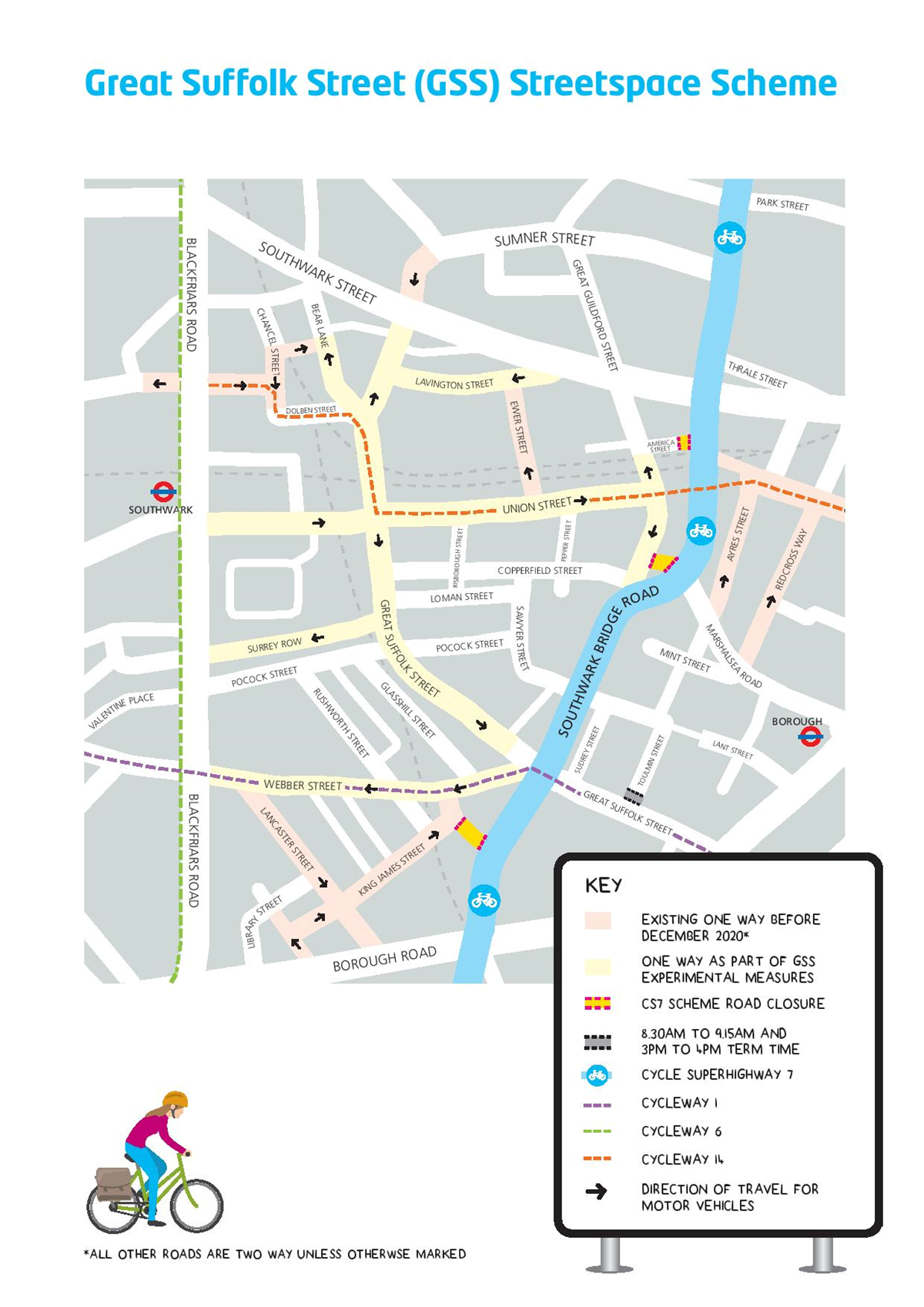
Existing one way before December 2020: includes Lancaster Street and King James Street.
One way as part of GSS experimental measures: includes Webber Street, Great Suffolk Street, Surrey Row, Union Street, Lavington Street and parts of Bear Lane.
CS7 Scheme Road closure: includes parts of Union Street and Dolben Street.
8:30am to 9:15am and 3pm to 4pm term time: part of Tolumin Street.
Page last updated: 15 August 2022